Case Study: Legana Landslide

Landslides have occurred in slopes adjacent to the Tamar River at Legana in Tasmania. Historically several houses in the region were extensively damaged by landslide movement and were demolished between 1991 and 2003. Geologically, the area is underlain by sand, sandstone, and clay of Tertiary age. These are overlain by Quaternary gravel and sand.

A program of investigation of the landslide and mitigation works were undertaken in 2021/22. A geotechnical working group was established, comprising:

  • A.S. Miner Geotechnical - geotechnical engineering, remediation
  • GeoTon - geotechnical drilling, geotechnical analysis
  • Mineral Resources Tasmania - geologic & geomorphic knowledge, monitoring, data management
  • pitt&sherry - project management, communication, geotechnical engineering input

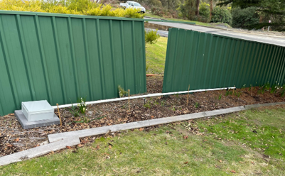
Mitigation works included improvements to surface drainage, repair of leaking pipes and installation of subsurface drains to relieve water pressure from the failure surface.

AT A GLANCE

Discover how a geotechnical working group established in 2021 used Viotel SMART Geotechnical Monitoring Systems  for mitgation eforts on any active landslip including draingage improvements, pipe repaires and subsurface drains.

KEY POINTS:

  • Real time monitoring of water table, rainfall and surface movements
  • Viotel's monitoring system includes piezometers, extensometers, corner reflectors, tilt meters.
  • All data is available on Viotels’ data management platform, myViotel

The Challenge

Reliable near real-time information was required to monitor the response of the water table to the drainage works and rainfall infiltration. Monitoring of surface movements across scarp areas of the landslide were also required to assess the effectiveness of the landslide mitigation works.

It was important that the various geotechnical working group and local government stakeholders could all easily access and interpret the monitoring data.

Viotel installed a network of 9 piezometers with Viotel IoT loggers in boreholes within the landslide and up slope above the back scarp. Two draw-wire extensometers with Viotel IoT loggers were installed across areas interpreted to be either internal scarps or back scarps of the landslide.

Corner reflectors for InSAR satellite monitoring were installed by Mineral Resources Tasmania. Viotel 3 Axis Tilt Meters were installed on the InSAR targets to provide finer resolution of target movements to complement the InSAR monitoring.

A Viotel Tilting Bucket Rain Gauge node was installed to provide a more direct source of rainfall data local to the area of interest.

The data was streamed via Viotel’s AWS Cloud database to a custom project dashboard created by Viotel. Access to the data and basic interpretive functions are also available via the myViotel platform. Alerts can be set for rainfall events, groundwater levels and displacements.

Stakeholders are able to remotely log into the dashboard from any internet connection and access a range of data plotting and interpretive functions.

Viotel Rain Gauge and Piezometer Installation

Landslide Monitoring

Viotel IoT Nodes are ideal for monitoring landslides. A remote monitoring network for landslides may comprise of monitoring elements for; rainfall and surface drainage, surface movements, deeper in-ground movement, soil moisture, and groundwater.

Monitoring of mitigation systems may also be undertaken, such as discharge from subsurface drains. Remote monitoring can also facilitate failure detection in services that cross landslides, such as water pipes, sewage, and stormwater pipes.

A simple rapid to deploy system of Viotel IoT nodes provides near real-time monitoring and alerting for landslides.

Viotel SMART Nodes equipped with Crack Meters, Extensometers, Load Cells, Soil Moisture probes, and Inclinometers can provide further insights on ground movements.

Viotel Tilt Nodes can be installed on poles to monitor near surface movements or on structures such as retaining walls, gabions, buildings etc.

The myViotelplatform, accessing Cloud-based data, transforms a sensor from a disconnected unintelligent asset to a networked live data device. Each Viotel Nodes has GPS location and the myViotel platform automatically searches for and sources the nearest weather station data from the Bureau of Meteorology, which with appropriate nodes can provide insights on groundwater response and ground movements in relation to weather events.

A Viotel Tilting Bucket Rain Gauge node can provide a more direct source of rainfall data local to the area of interest.

The Viotel Nodes are safe, self-contained IoT sensor packs which are discrete, simple to install and calibrate, powered with mains / battery &/or solar power and with analysis power via on-board microprocessors.

Viotel Installation Services

Draw Wire Extensometer Installation

Tiltmeter on InSAR reflector

Custom Dashboard


Viotel SMART Geotechnical Monitoring Systems are applied to monitor; landslides, rockfaces, excavations, dams for settlement, displacement, tilt, strong ground motion (earthquake), piezometric head, and rainfall.

Our Structural Health Monitoring Systems can be used to assess the impacts of geotechnical conditions on structures.


For more information on Viotel Products and Solutions - head to our contact page or send a message to [email protected]

Download our corporate brochure

Speak to an Expert

Request a Quote

Join our Team